
Projects
Integrated Coastal Modeling (ICoM)
The Integrated Coastal Modeling (ICoM) is a multi-institutional and multi-disciplinary project led by PNNL and funded by the DOE Office of Science. It has a long-term vision to “deliver a robust predictive understanding of coastal evolution that accounts for the complex, multi-scale interactions among physical, environmental, and human systems”. In this project, our group’s responsibility is to integrate multiple higher-resolution oceanic and atmospheric models to estimate better the impact of extreme flooding events in the future climate.
This following animation shows an example of the integrated model result: maximum water surface elevation (in meters, NAVD88) in the Delaware Bay during Hurricane Irene (2011)
Click here to learn more about our model setup and recent publications from this work
Tidal Energy Resource Refinement
In this DOE Water Power Technologies Office funded project, we collaborated with the Georgia Institute of Technology to improve the present-day assumptions in analytic estimates of in-stream tidal power availability. Mainly, we are working to verify and test the widely used Garrett and Cummins (2005) methodology; developed for regional-scale tidal channel energy resource assessments. At the same time, we are also leading another tidal energy modeling case study in Tacoma Narrows, WA, to see how we can apply the International Electrotechnical Commission (IEC) standards for resource characterization to realistic sites.

The setup of the idealized case used to verify Garrett and Cummins (2005)

Figure shows the model domain and setup for the IEC case study. In the middle subplot, we can see the Salish Sea Bathymetry and the 19 river locations used to represent the fluvial forcing
Click here to learn more about our model setup and recent publications from this work
Tidal Turbulence Modeling
This collaborated project between PNNL and The National Renewable Energy Laboratory (NREL) focuses on the field and numerical assessment of tidal turbulence and flow characteristics at Western Passage near Eastport, Maine, a top-ranked U.S. tidal energy site. Field data sets of high temporal resolution have been collected using numerous bottom and ship-mounted instruments, and subsequently, they are used for the 3D ocean model validation. Ultimately, the modeling study aims to help turbine deployment site selection and provide critical flow dynamics information for device design.
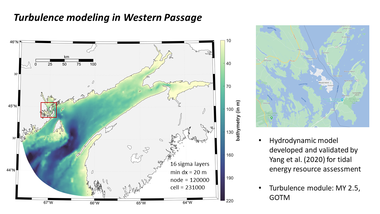
The figure shows our hydrodynamic model domain covering the study area Western Passage, Maine.